12 Hikes in Arizona So Wild, You’ll Wonder If You’re Still on Earth

When people think of Arizona, most likely, the first thing that comes to mind is the Grand Canyon. But there’s so much more to this southwestern state than just one famous attraction. Arizona is a hiker’s paradise, with photogenic slot canyons, turquoise-colored desert waterfalls, and endless terrain of red rock trails to explore.
I vanlifed for two years and road-tripped through Arizona for months, uncovering its best-kept secrets and falling in love with its gorgeous landscapes. This incredible state has become one of my absolute favorite outdoor destinations in the world.
So, here are some of my favorite and best hikes in Arizona that will inspire you to get back outdoors!
1. Devil’s Bridge Trail
- Location: Sedona
- Difficulty: Moderate
- Length: 3.9 mile out-and-back trail
- Highlights: Natural sandstone arch
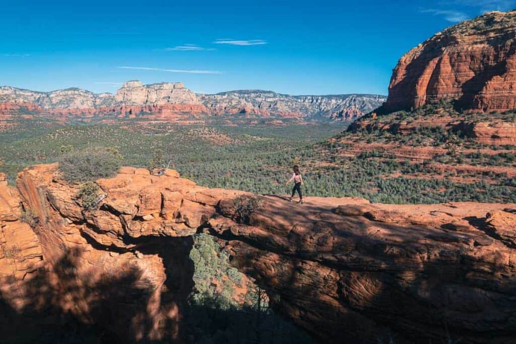
If you’re going to the outdoor wonderland that is Sedona, Devil’s Bridge Trail should absolutely be on your list. This moderate hike takes you through the gorgeous red rock landscapes that Sedona is famous for.
One of the main highlights of this trail is the natural sandstone arch known as Devil’s Bridge. It’s the largest natural sandstone arch in the area, and the views from here are breathtaking.
You’ll be amazed at the sweeping views of the surrounding canyons and distant mountains. Many hikers take a moment to carefully walk out onto the arch for a thrilling photo opportunity.
Travel Tip: Get there right when the sun is rising or late in the afternoon, as the parking fills up, and the photo line sometimes becomes hours of waiting!
📖 Read Also: 24 Hours in Sedona: Perfect First-Timer’s Guide to the City

2. Piestewa Peak Summit Trail
- Location: Phoenix
- Difficulty: Strenuous
- Length: 2.4 miles out-and-back trail
- Highlights: City skyline views, steep climb
- Recommended Tours: Guided Sunset Piestewa Peak Trip
I can’t believe such a beautiful hike is right smack in the middle of one of America’s largest cities. Spanning 2.4 miles round trip, the Piestewa Peak Summit Trail in Phoenix promises a fantastic workout and some of the best city skyline views you’ll find in the area.
This hike may seem short, but its steep incline and rocky terrain make it challenging. The trail mixes switchbacks and steep steps to the top.
Many people go for the sunset, but I went at night right before the park closed. Seeing the city lights flickering underneath the night sky filled with stars was a spectacular sight.
📖 Read Also: Epic One Day in Phoenix Itinerary for First-Timers
3. Bright Angel Trail
- Location: Grand Canyon National Park
- Difficulty: 9 miles out-and-back trail to Phantom Ranch (but can opt for shorter or longer)
- Highlights: Sweeping canyon views, Colorado River overlooks
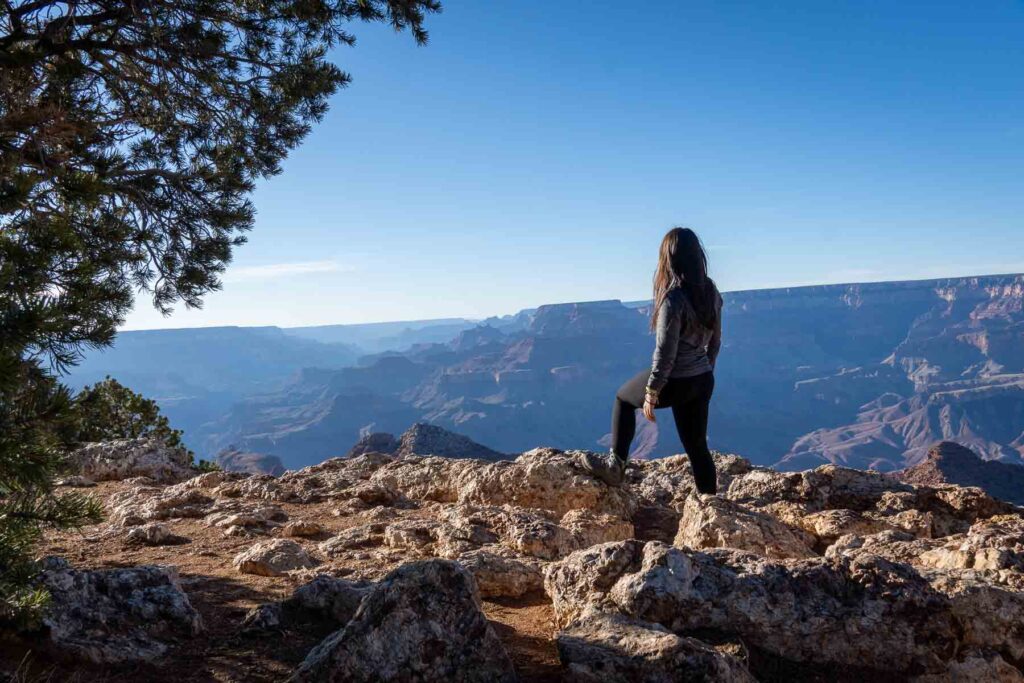
It wouldn’t be an article about the coolest hikes in Arizona without including at least one at the Grand Canyon. While there are numerous trails to choose from, Bright Angel Trail is a classic and should definitely be on your list.
This historic trail descends the canyon 4380 feet to the Colorado River, with expansive views the whole way. It’s a strenuous hike with steep switchbacks and exposed sections with very little shade.
You can do the entire hike to Phantom Ranch or opt for shorter day hikes. Many will turn back at places like Three Mile Resthouse or Havasupai Gardens.
📖 Read Also: 10 of the US National Parks’ Most Iconic Landmarks.
4. Havasu Falls Trail
- Location: Supai
- Difficulty: Moderate
- Length: 24.4 mile out-and-back trail
- Highlights: Turquoise waterfalls, Navajo Culture
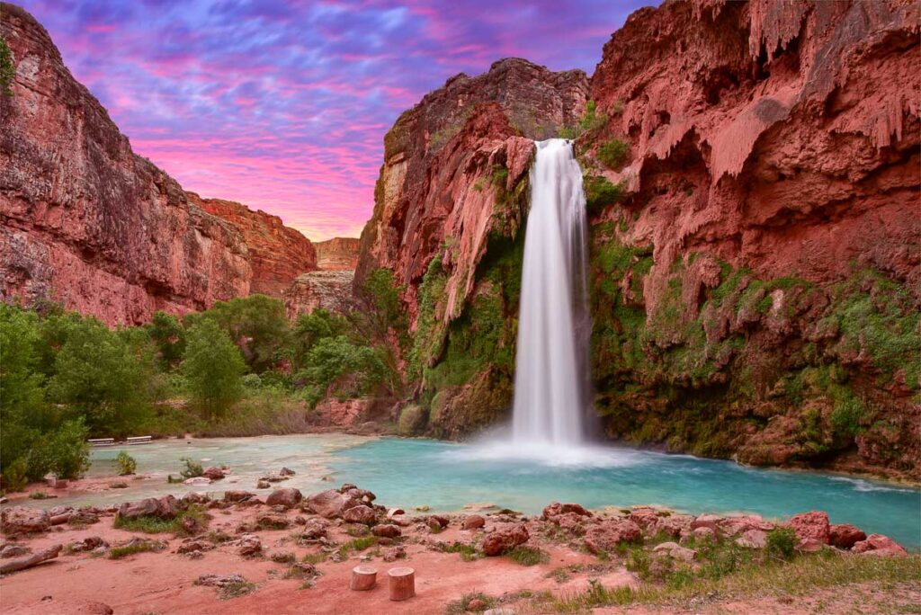
If you’ve ever dreamt of discovering a hidden oasis in the middle of the desert, the Havasu Falls Trail should top your bucket list. Deep in the Grand Canyon, this trail leads to some of the most sensational turquoise waterfalls you’ll ever see.
Imagine cascading blue-green waters surrounded by deep red rock cliffs. It’s honeslty something straight out of a fantasy! The trail weaves through lands that are home to the Native American Havasupai tribe, giving you a unique peek into Navajo culture.
Travel Tip! Released only once a year, the permit to this hike is one of the most coveted in America. Plan well ahead and click the button to try getting a permit as soon as they’re released in February.
📖 Read Also: 14 Must-See Waterfalls in West US You Didn’t Know About
5. White Pocket Trail
- Location: Vermillion Cliffs National Monument
- Difficulty: Moderate to difficult
- Length: 3 miles out-and-back trail
- Highlights: Otherworldly rock formations, slot canyons
- Recommended Tours: 4×4 White Pocket Private Outing
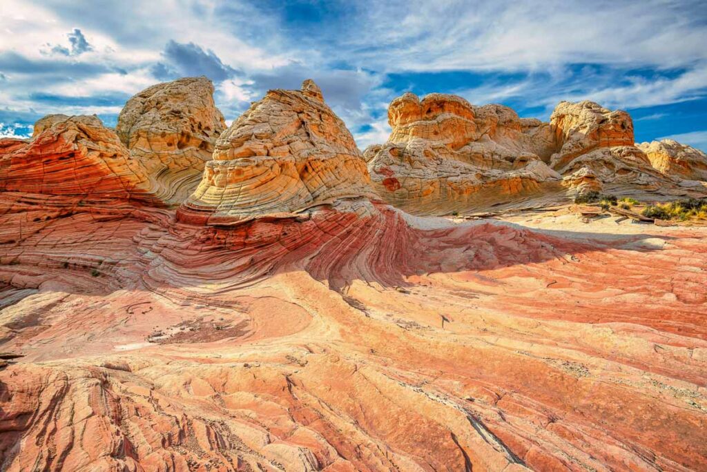
In the remote and stunning Vermillion Cliffs National Monument, you’ll find an otherwordly landscape that looks like something straight out of a sci-fi movie.
The rock formations here are layers upon layers of swirling sandstone in white, red, and orange hues. The White Pocket Trail leads through layers of twisted and distorted sandstone. One moment, you’re walking through wavy, colorful rocks, and the next, you’re discovering narrow slot canyons.
Due to the rough terrain, this trail is best done with a guide or in a high-clearance vehicle.
Fun Fact! The area was named “White Pocket” because settlers noticed small depressions in the rock formations that would fill with water, creating natural pools that looked like little pockets.
Note: The similar-looking “Wave” hike is positively gorgeous, but since most of the hike is in Utah (even though the attraction is in Arizona), I decided not to include it in the list.
🏜 It’s highly recommended to use a 4×4 to get to the trailhead. This private White Pocket trip will provide round-trip transportation to take the hassle out of getting stuck in deep sand.
📖 Read Also: 7 Coveted National Park Experiences that Require Entering a Lottery
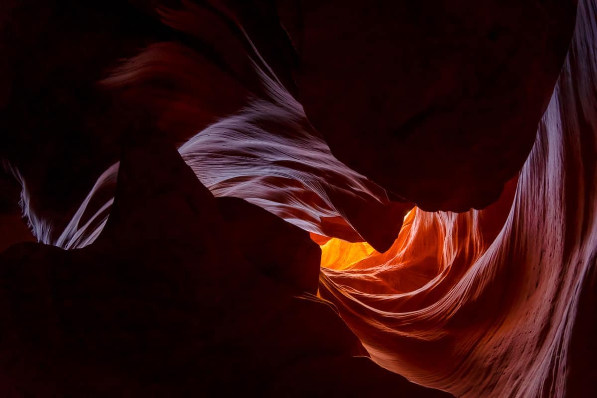
6. Antelope Canyon
- Location: Page
- Difficulty: Easy
- Length: 1.1 miles round trip for Lower Antelope Canyon, 0.5 miles for Upper Antelope Canyon
- Highlights: Slot canyon, famous photography spot, light beams
- Recommended Tours: Lower Antelope Tickets, Upper Antelope Tickets
Antelope Canyon is hands down one of the most iconic natural wonders in Arizona, if not the entire United States. It’s a place I had dreamed of going for years, and it is every bit as beautiful as in the pictures.
It’s a photographer’s dream, with its ethereal beams of light piercing through the narrow sandstone passageways. Located near Page, this slot canyon is divided into six sections, but the most popular are Upper Antelope Canyon and Lower Antelope Canyon.
Sure, it’s still considered a hike, but it’s more like a walk with several photo stops along the way.
Travel Tip! Tours are required for most sections of Antelope Canyon, and they fill up quickly. Book in advance and choose the best time for light beams, usually midday from March to September.
📖 Read Also: 11 American Places So Surreal, You’ll Think They’re Photoshopped
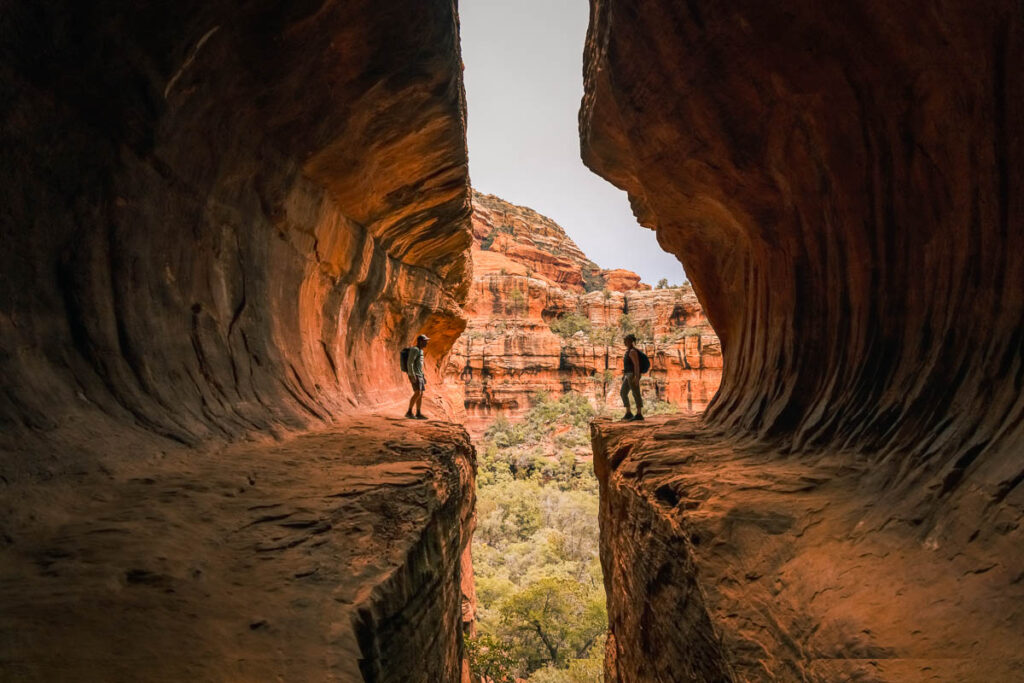
7. Secret Subway Cave on Boynton Canyon Trail
- Location: Sedona
- Difficulty: Moderate
- Length: 6 miles round trip
- Highlights: Red rock formations, vortex location
One of the coolest hidden gems in Sedona is the Secret Subway Cave on the Boynton Canyon Trail. You walk through towering red rock formations and ancient ruins before stumbling upon a natural cave that resembles a subway tunnel—it’s absolutely epic!
The cave gets its name from its unique shape, which looks like a curving archway carved into the sandstone. It’s a favorite spot among hikers because of the fun scramble to get there.
The cave’s interior is spacious enough to explore, and you’ll often find visitors sitting inside. The Boynton Canyon area is known for its spiritual energy, and the Subway Cave is often considered a “vortex” spot where people go to meditate and connect with the Earth.
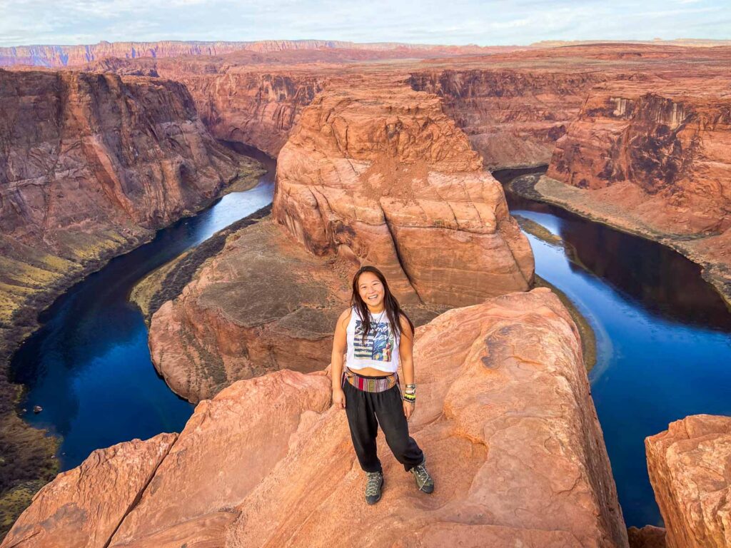
8. Horseshoe Bend
- Location: Near Page
- Difficulty: Easy
- Length: 1.5 miles round trip
- Highlights: Iconic horseshoe-shaped bend in the Colorado River
- Recommended Tours: Combine Lower Antelope Canyon with Horseshoe Bend
If you’ve ever seen a photo of a dramatic horseshoe-shaped bend in the Colorado River, then you’ve probably seen Horseshoe Bend. This is another Arizona classic in Page.
The hike to Horseshoe Bend is an easy one, with clear signs leading the way from the parking lot to the overlook. From there, you can see sweeping views of the river formed over millions of years by erosion, creating a dramatic 1,000-foot drop into the river below.
For more adventure, you can order a backhaul service and actually kayak the bend from below! It’s one of the most extraordinary things I’ve done in Arizona.
📖 Read Also: 14 Western US State Parks That Rival Any National Park
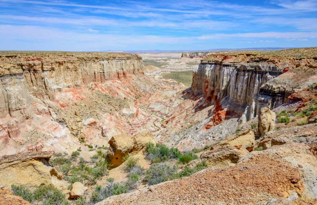
9. Coal Mine Canyon
- Location: Tuba City
- Difficulty: Easy to moderate
- Length: 0.5 to 3 miles
- Highlights: Unique rock formations, Native American culture
Coal Mine Canyon is one of Arizona’s most underrated hiking spots in the state. Located near Tuba City on Navajo and Hopi lands, the area is steeped in Native American history. It’s an important site for the Hopi people, who believe their ancestors were created from these rocks.
The canyon gets its name from the visible coal streaks that line its walls, remnants of the area’s mining history. With its easy-to-moderate trails, hikes here will take you through a landscape with layered rocks in shades of red, orange, white, and even purple.
📖 Read Also: 7 Heart-Stopping Canyons in the US, And Why They Beat the Grand Canyon
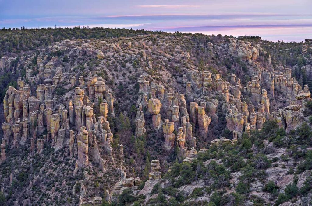
10. Echo Canyon Loop
- Location: Chiricahua National Monument
- Difficulty: Moderate
- Length: 3.3 mile loop
- Highlights: rock spires, narrow canyons
Head to Chiricahua National Monument to take on the Echo Canyon Loop Trail through an area that was once a volcanic hotspot about 27 million years ago.
This moderate hike takes you through rock spires and balanced rocks known as the “Wonderland of Rocks.” One of the highlights of this trail is the “Echo Wall,” where you can yell or clap your hands to hear your voice echo through the canyon.
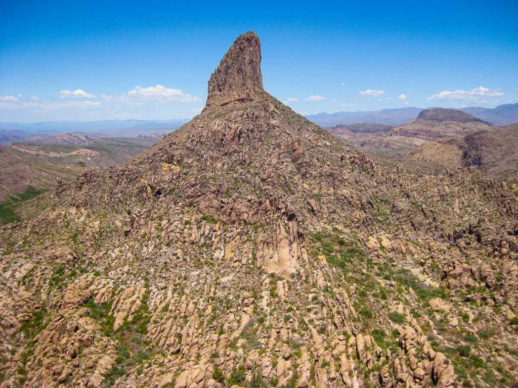
11. Summit Weavers Needle Peak
- Location: Superstition Mountains
- Difficulty: Difficult
- Length: 12.4 miles round trip
- Highlights: Panoramic views, desert wildflowers
Our next adventure takes us to the Summit Weavers Needle Peak, one of the most challenging yet rewarding hikes in the Superstition Mountains. This towering rock spire stands at 4,555 feet and was named for its unique, needle-like appearance. It is a prominent landmark that can be seen from many points in the Phoenix area.
The journey to the summit is filled with steep ascents and rugged terrain, with panoramic desert views and beautiful wildflowers in spring.
Legend has it that Weavers Needle was historically believed to contain hidden gold left behind by the elusive Lost Dutchman.
📖 Read Also: The Top 8 Hardest Hikes in US National Parks and Why They’re Worth It
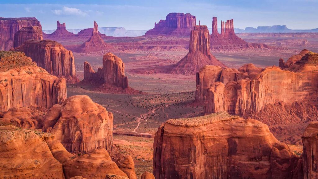
12. Wildcat Trail, Monument Valley
- Location: Navajo Tribal Park
- Difficulty: Easy to moderate
- Length: 3.9 miles round trip
- Highlights: Up-close butte monuments, Navajo culture
- Recommended Tours: Complete Monument Valley Excursion
Our last hiking recommendation (but certainly not the last) takes us to Monument Valley, a place known for its one-of-a-kind rock formations that jut out from the otherwise flat landscapes. The Wildcat Trail is the only self-guided hike in the Navajo Tribal Park and offers an up-close view of some of the area’s most iconic monuments.
As you walk along this easy-to-moderate trail, you’ll see the Native American culture permeating throughout Monument Valley. You can even stop and visit the Hogan, a traditional Navajo dwelling still used by families today.
📖 Read Also: 8 American National Parks That Keep Showing Up in Your Favorite Films
Final Thoughts: Best Hikes in Arizona
With so many beautiful hiking spots in Arizona, choosing just a few is hard! I’ve been all around the state, and I promise these hikes will not disappoint. From looking out over Horseshoe Bend to the hidden gems of Coal Mine Canyon and Secret Subway Cave, each hike really showcases Arizona’s diverse landscapes.
So, what do you think? Which incredible Arizona hikes am I missing?
Don’t close that tab just yet…Where to Next in Arizona?
Arizona is amongst my top favorite places in the world. I’ve vanlifed around and through this great state back and forth, north and south, multiple times on my road trips. If you’re looking for more itineraries on Arizona, check out these other destinations.
- Perfect One Day In Petrified Forest National Park Itinerary
- One Day in Saguaro National Park Itinerary for First-Timers
- One Day in Grand Canyon South Rim: First-Timers Itinerary
Catherine, a seasoned travel writer, has lived in 4 different states and explored 36 states and 28 national parks. After spending two years embracing van life, she's now dedicated to sharing her vast knowledge of day trips across America. Catherine's other works has been referenced in major publications like MSN, Self, and TripSavvy.
| MY FAVORITE TRAVEL RESOURCES |
✈️ Find amazing guided tours and experiences with Viator to maximize your time! 🏘️ Plan ahead and secure your accommodation with Booking.com in advance. 🧾 Rent a car with Discovercars in advance and get the best prices for your day trip adventures. |

