14 Rare Weather Phenomena You Won’t Believe Happen in the US

Have you ever looked at the sky and thought, “That looks weird?” The United States is no stranger to some jaw-dropping and downright bizarre weather phenomena.
Because if you think you’ve seen it all, think again. From rare cloud patterns to fire tornados, find out the craziest weather occurrences that you didn’t even know you needed to run from.
1. Lenticular Clouds
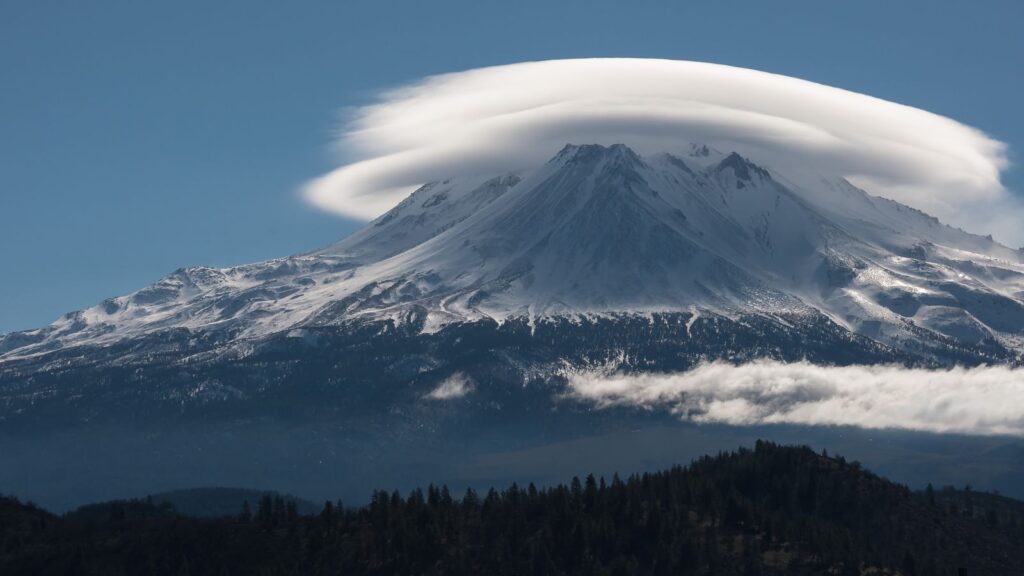
Ever seen a UFO? No, not the kind piloted by little green men, but the lenticular clouds over the Sierra Nevada that look like flying saucers!
These smooth, lens-shaped clouds form when moist air flows over mountains and creates standing waves in the atmosphere. At their peak, they condense and form these bizarre shapes.
Pilots avoid them because they can cause turbulence, but they’re a visual beauty for the earthbound. The best spots to catch them are around tough mountain peaks like Mount Shasta or Mount Whitney in the Sierra Nevadas.
2. Morning Glory Clouds
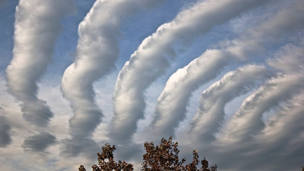
Imagine waking up to see a rolling cloud that stretches as far as the eye can see. Though Morning Glory Clouds are more famous in Australia, similar phenomena have occasionally been observed in Cape Cod and along the Gulf of California.
These clouds can stretch up to 600 miles long and look like a giant rolling pin in the sky. They move at speeds up to 35 mph, so you might not see them for long! These clouds are really rare and usually form in the early hours of the day.
3. Nacreous Clouds
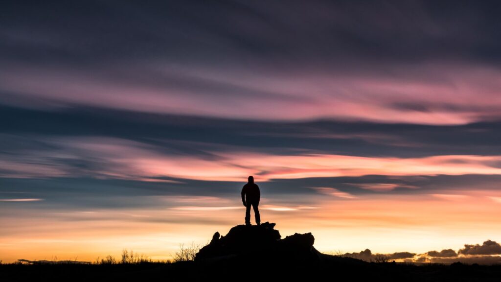
If you’ve ever wanted to see the rainbowy clouds, head to northern states like Montana and Alaska to catch a glimpse of nacreous clouds. Also known as the “mother of pearl” clouds, these high-altitude formations shine with iridescent colors that make the sky look like an opal.
They form in the stratosphere, about 9 to 16 miles above Earth, and are most visible during winter. These clouds are best viewed during twilight when the sun is just below the horizon.
4. Mammatus Clouds
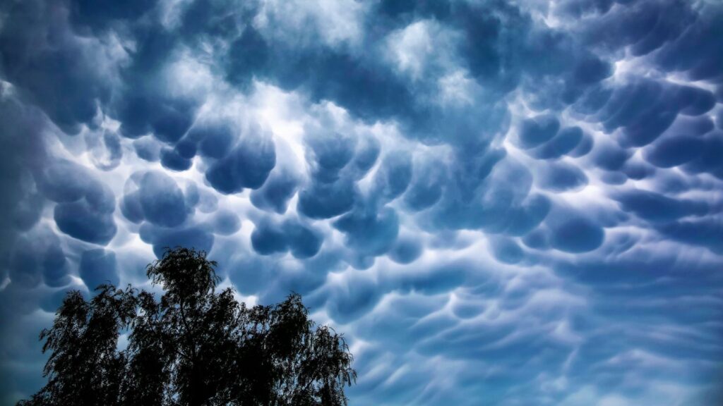
If you spot pouch-like clouds hanging ominously in the sky after a thunderstorm, you’ve encountered mammatus clouds. These eerie formations often appear after severe weather in places like Kansas, Nebraska, and Oklahoma.
Each “pouch” can be up to a mile wide and dip down as far as half a mile. They’re a sign that the atmosphere is still unstable, so while they’re fascinating, maybe locate the next closest bunker nearby.
5. Supercell Storms
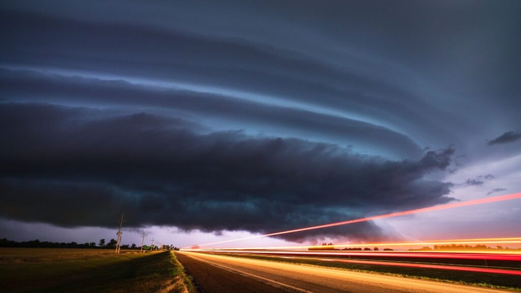
In Tornado Alley, supercell storms are the champions of severe weather. These rotating thunderstorms can spawn tornadoes, hail the size of grapefruits, and winds that could knock you off your feet.
States like Texas, Oklahoma, and Kansas are prime spots for these powerful storms. A supercell can last several hours and stretch over 20 miles in diameter. They often feature a mesocyclone, a rotating updraft that makes the storm look like a giant, swirling cauldron.
6. Frost Flowers
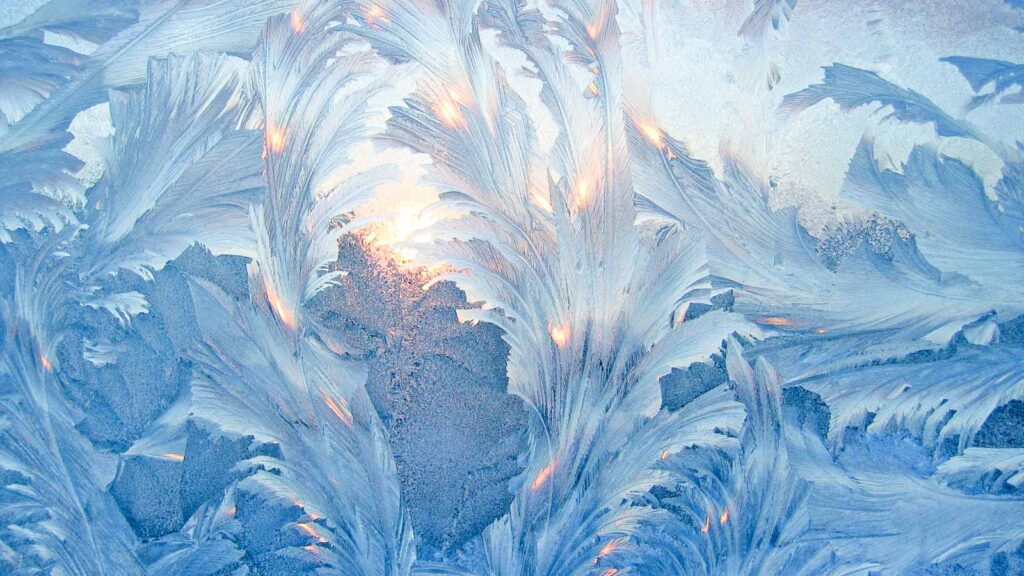
Found in arctic regions like Alaska during winter, frost flowers are delicate ice formations that grow on plants and frozen surfaces when the air is colder than the surface. They resemble intricate, crystalline blooms two to three inches tall spun from the finest glass.
The delicate structures are formed by water vapor freezing upon contact.
7. Snow Rollers
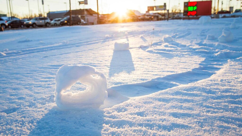
Nature can make their own snowmen, and they’re called snow rollers. Found in mountainous regions like the Rockies, these rare cylindrical formations are created by the wind, which rolls snow into donut shapes.
Snow rollers can range from the size of a baseball to a washing machine and are usually hollow in the center. They require just the right mix of wet snow, wind, and temperature to form.
8. Fire Whirls
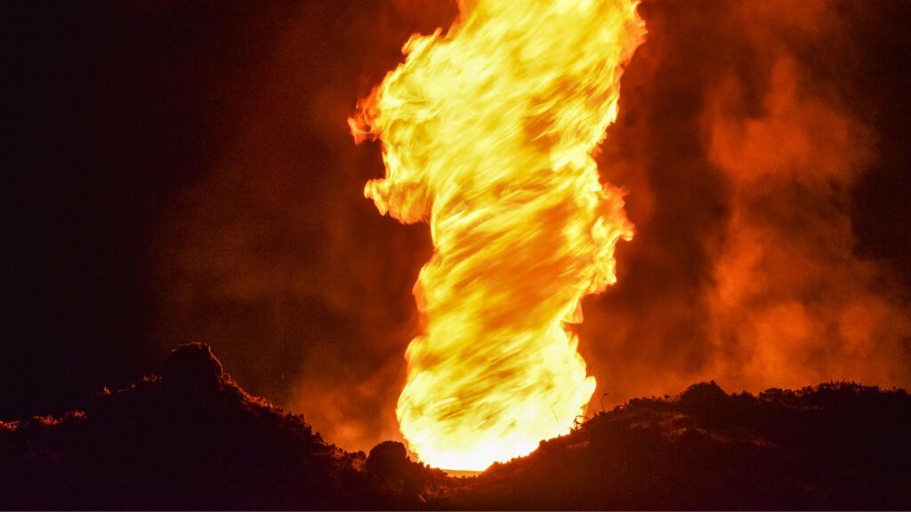
California’s wildfires are no joke, and neither are the fire whirls they sometimes produce. Also known as fire tornadoes, these intense, swirling columns of fire are created by the combination of extreme heat and turbulent air.
Picture a regular tornado, but replace the debris with flames, and you’ve got a fire whirl.
They can reach heights of over 1,000 feet and temperatures exceeding 2,000 degrees Fahrenheit. During the Carr Fire in 2018, Redding, California, experienced a terrifying fire whirl that caused significant destruction.
These fiery vortices are rare but incredibly dangerous. If you see one, run the other way.
9. Ball Lightning
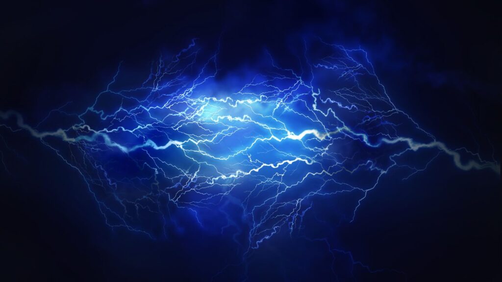
Ball lightning is one weird weather phenomenon. These mysterious spheres of light can appear during thunderstorms and float around like ghostly orbs, sometimes even passing through windows!
They can range in size from a golf ball to a beach ball, lasting from a few seconds to several minutes. Scientists are still scratching their heads over what causes ball lightning, but theories range from plasma to nanoparticles.
Sightings have been reported across the US, from rural farms to bustling cities.
10. Ice Tsunamis
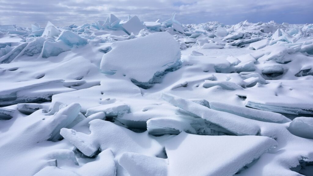
When winter gets dramatic around the Great Lakes, you might witness an ice tsunami, also known as an ice shove. Strong winds and water currents push massive sheets of ice ashore, creating walls of ice that can be several feet high.
It may not sound as bad as an actual tsunami, but these ice walls can move rapidly and damage anything in their path. In 2019, Lake Erie saw an impressive ice tsunami that shocked locals.
11. Ice Jams
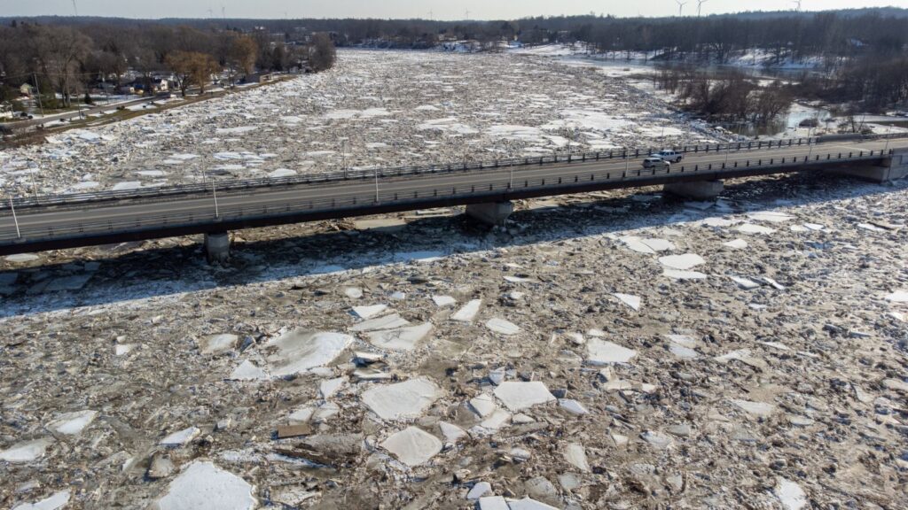
Ice jams are a river’s traffic jams. They occur in northern rivers during the spring thaw. Chunks of ice block the river flow, causing upstream flooding and the potential for a sudden downstream release.
The Susquehanna River in Pennsylvania is notorious for these icy logjams. When an ice jam breaks, it can unleash a torrent of water and ice that sweeps away everything in its path.
12. Sundogs
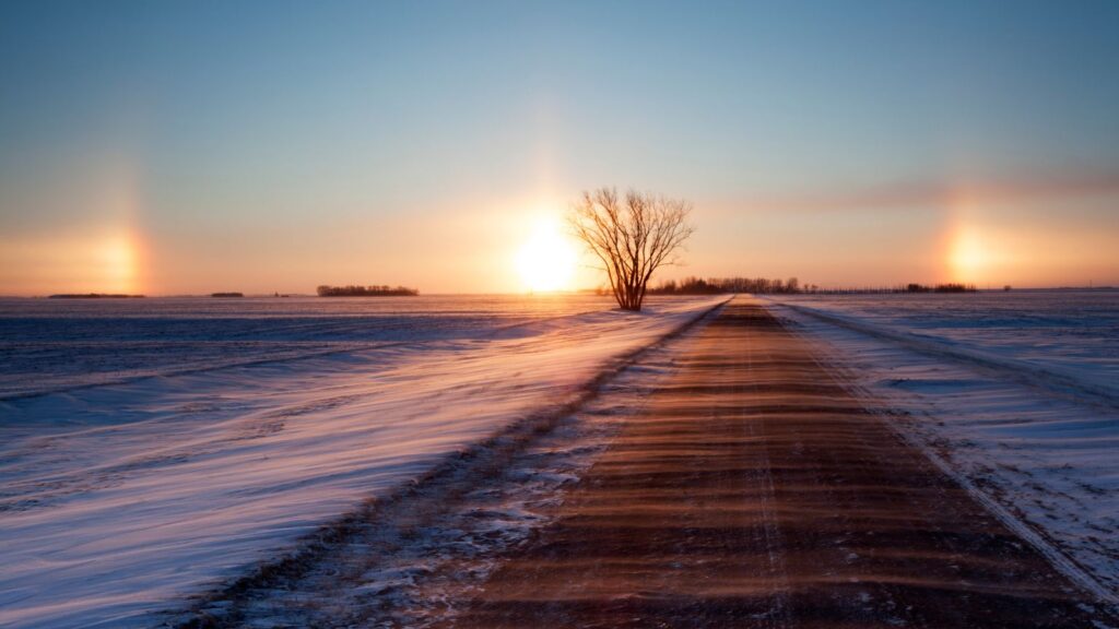
Formed by ice crystals in the atmosphere, Sundogs appear as bright spots on either side of the sun, creating a halo effect. You’ll often see them in places like Minnesota, where winter temperatures plummet.
Sundogs can be so bright that they’re sometimes mistaken for a second sun, leading some to call them “phantom suns.” They’re most visible when the sun is low on the horizon, so early morning or late afternoon.
13. Haboobs
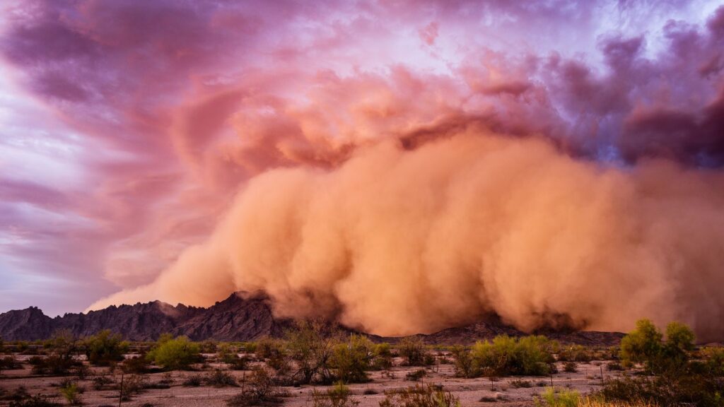
Haboobs are intense dust storms caused by strong winds from collapsing thunderstorms. They create a towering wall of dust that can stretch for miles.
The deserts of the southwest USA are a prime spot for these dramatic weather phenomena. These dust walls can reach heights of up to 3,000 feet and move at speeds of 30 miles per hour.
Driving through one feels like a scene from “Dune,” so it’s best to pull over and wait it out as you’ll be flying blind. They’re rare but unforgettable, leaving everything coated in a fine layer of desert dust.
14. Ghost Apples

In the Midwest orchards, freezing rain can encase rotting apples in a shell of ice, leading to the phenomenon known as ghost apples. As the apple decays, it slips out, leaving behind a hollow, eerie ice shell.
These ghostly formations are fragile and rare, making them a treat for anyone lucky enough to stumble upon one.
Catherine, a seasoned travel writer, has lived in 4 different states and explored 36 states and 28 national parks. After spending two years embracing van life, she's now dedicated to sharing her vast knowledge of day trips across America. Catherine's other works has been referenced in major publications like MSN, Self, and TripSavvy.
| MY FAVORITE TRAVEL RESOURCES |
✈️ Find amazing guided tours and experiences with Viator to maximize your time! 🏘️ Plan ahead and secure your accommodation with Booking.com in advance. 🧾 Rent a car with Discovercars in advance and get the best prices for your day trip adventures. |

