26 Can’t Miss Day Trips from San Francisco Less Than 3 Hours Away

Living in or visiting San Francisco has its perks, but sometimes, you just need to get away from the skyscrapers. The city’s pace, parking stress, and fog can wear you down fast, and spending a whole weekend planning a full vacation isn’t always realistic.
This is why I love California. Within three hours, you can be sipping wine, walking under redwoods, or sitting by an actual stretch of ocean you would want to swim in without checking into a hotel or catching a flight.
During my two-year van life stretch, San Francisco became a regular stop, and I’ve learned which spots are actually worth the drive and which ones feel like a waste of gas. These easy day trips from San Francisco, all under three hours, are the ones I would go back to.
Easy Day Trips from San Francisco: Less than 1 Hour
1. Sausalito
Distance: 11 miles / 25 minutes
Type: Urban
Best Time to Go to Sausalito: Year-round
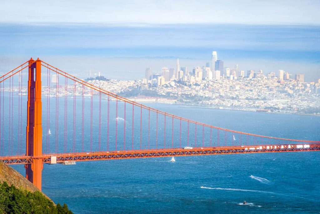
During World War II, Sausalito once housed a shipyard and later became a houseboat haven for artists and musicians. Now, it’s one of the easiest escapes across the Golden Gate.
The main street, Bridgeway, runs along the bay and is lined with small shops and public art installations. Nearby, Fort Baker, trails weave past bunkers and military buildings. The ferry ride to or from the city doubles as a scenic tour, especially when timed for sunset. If you’re biking, the return trip over the Golden Gate Bridge is all downhill.
2. Alcatraz

Distance: 20 minute ferry from Pier 33
Type: Historical & Cultural
Best Time to Go to Alcatraz: Fall for fewer crowds
Alcatraz held some of the country’s most notorious inmates, but it was a Civil War-era military fort before that. A major Native American occupation in 1969 also helped spark the Red Power movement.
Ferries leave from Pier 33, which has strong views of both bridges and the skyline the whole time. Once on the island, the self-guided audio tour walks through old cell blocks, solitary units, and the warden’s office. You can also explore the old lighthouse, native plant gardens, and former guard housing on the hillside.
3. Pacifica

Distance: 14 miles / 20 minutes
Type: Nature & Outdoors
Best Time to Go to Pacifica: Summer for beach weather
Pacifica has one of the most consistent surf breaks in the Bay Area and a shoreline built for fog. Even in summer, it feels cooler and quieter than other nearby beaches.
Linda Mar Beach is the main draw for surfers, but there’s a wide sand and a path that runs along the bluff for everyone else. Mori Point has trails that climb up to a headland overlooking the water. The Devil’s Slide Trail, a former highway section now reserved for bikes and pedestrians, gives cliffside views without the traffic.
4. Tiburon

Distance: 17 miles / 40 minutes
Type: Nature & Outdoors
Best Time to Go to Tiburon: Spring for wildflowers on the trail
Tiburon was once a ferry and rail terminal that helped move goods throughout the Bay Area. These days, it’s a peaceful town with easy access to Angel Island, a former immigration station turned state park.
Catch the ferry to Angel Island and take the loop trail around the island or hike to the summit of Mount Livermore. The Old St. Hilary’s Preserve is a quick hike to a ridge with sweeping views and is known for its wildflowers in spring. On a clear day, you can see from the Marin Headlands all the way to Oakland.
5. Muir Woods National Monument
Distance: 17 miles / 40 minutes
Type: Nature & Outdoors
Best Time to Go to Muir Woods: Winter for the greenest trails
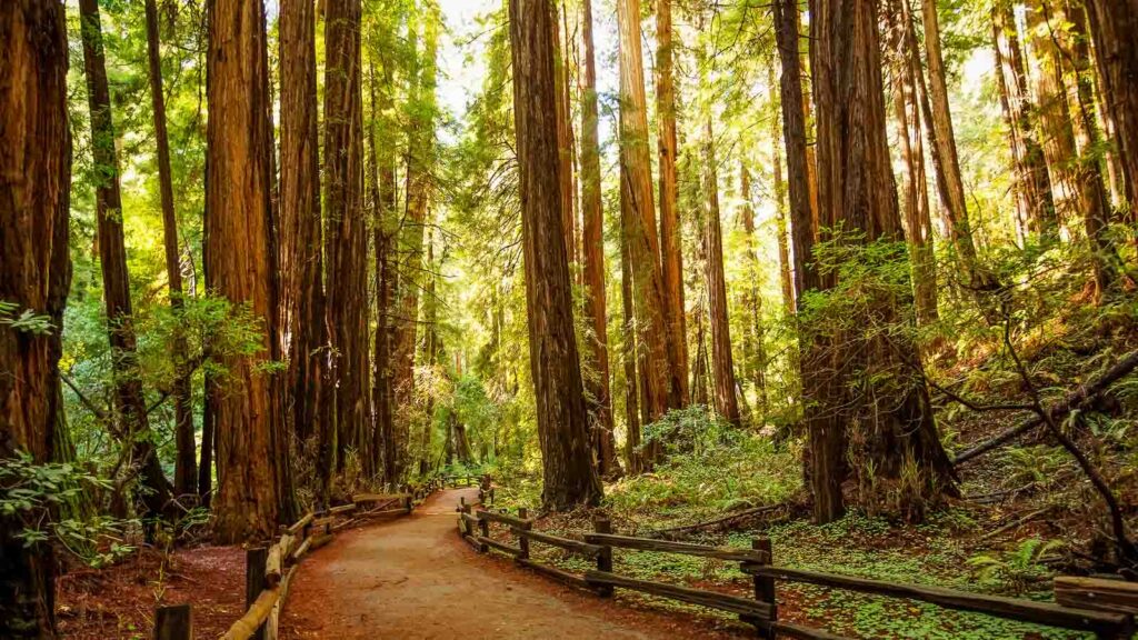
As one of San Francisco’s best day trips, Muir Woods holds one of the Bay Area’s last stands of old-growth redwoods and is a federally protected monument. Some of the trees here are over 600 years old.
Boardwalk paths follow Redwood Creek and lead into dense forest areas where sunlight barely filters through the canopy. Cathedral Grove is one of the most visited spots in the park. For longer hikes, trails connect to Mount Tamalpais State Park, including the Dipsea and Sun trails.
6. Stinson Beach

Distance: 24 miles / 45 minutes
Type: Nature & Outdoors
Best Time to Go to Stinson Beach: Summer for ocean swimming
Stinson Beach is one of the few places near San Francisco where you can actually swim, depending on the surf. It’s a small coastal town bordered by the Pacific Ocean on one side and Mount Tam on the other.
The beach stretches for nearly a mile and is backed by dunes and grassy areas. Hiking trails from nearby Pantoll Station connect down to the coast or up toward Mount Tamalpais.
The Dipsea Trail, one of the oldest trail races in the country, ends at Stinson and is a challenging climb through the forest. Just north of the main beach area is Upton Beach, which is less crowded and backed by bluffs.
7. Half Moon Bay
Distance: 30 miles / 40 minutes
Type: Nature & Outdoors
Best Time to Go to Half Moon Bay: Fall for pumpkin season
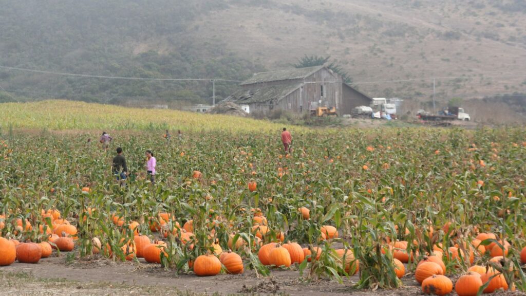
Half Moon Bay hosts one of the largest pumpkin festivals in the country every October and sees record-breaking waves at Mavericks in winter.
Drive Highway 1, and you’ll pass coastal farms, beaches, and horseback riding stables, all in the span of a few miles. The Coastal Trail runs parallel to the shore and connects multiple state beaches like Poplar and Venice. Fitzgerald Marine Reserve, just north of town, has some of the best tide pools in the region.
8. Marin Headlands

Distance: 10 miles / 35 minutes
Type: Nature & Outdoors
Best Time to Go to Marin Headlands: Spring for clear skies and blooms
The Marin Headlands were once military grounds and still have bunkers, missile sites, and tunnels hidden in the hills. It’s now part of the Golden Gate National Recreation Area, with trails that trace the coast and ridgelines.
Rodeo Beach is the main access point, a dark sand beach where surfers and seals can be seen on the same day. Battery Spencer has one of the best head-on views of the Golden Gate Bridge. The Point Bonita Lighthouse is still active and can be reached by foot through a tunnel and across a narrow bridge.
Best Day Trips from San Francisco: Less than 2 Hours
9. Point Reyes National Seashore
Distance: 37.1 miles / 1 hour 15 minutes
Type: Nature & Outdoors
Best Time to Go to Point Reyes: Spring for wildflowers and whale migration
The San Andreas Fault cuts straight through Point Reyes, separating it geologically from the rest of California. You’re literally walking on a chunk of land that’s sliding its way north.
Start at the Cypress Tree Tunnel or the Point Reyes Lighthouse, two of the most recognizable landmarks. Hike the Bear Valley Trail for a solid route that brings you to the coast without much fuss. The Tule Elk Reserve is worth visiting in late summer and fall when the males bugle and clash antlers.
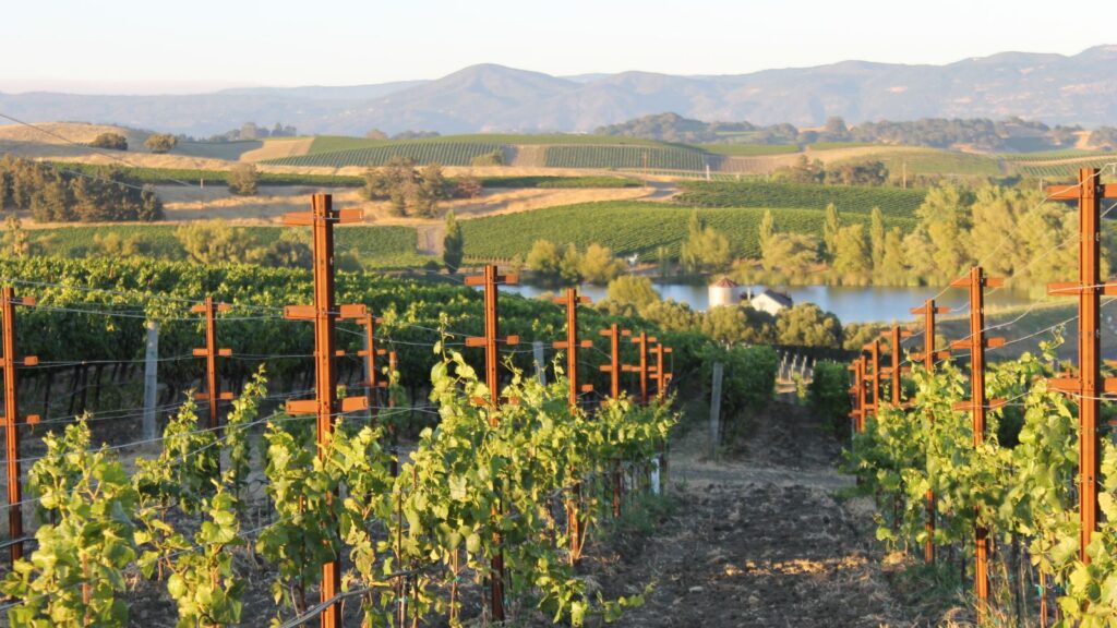
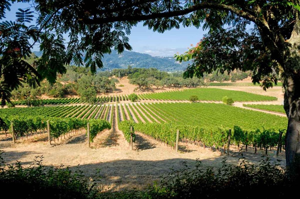
10. Sonoma
Distance: 44.7 miles / 1 hour 15 minutes
Type: Historical & Cultural
Best Time to Go to Sonoma: Fall for harvest season
Sonoma is neighboring Napa Valley’s more low-key, much more affordable destination. The central plaza is a historic landmark and includes the Mission San Francisco Solano, Sonoma Barracks, and other 19th-century buildings that played a role in California’s transition from Mexico to the US.
Just outside of downtown, you’ll find preserved adobe homes, hiking trails, and delicious wineries. Multiple bike routes pass through the surrounding countryside, especially the Sonoma Valley Trail, which connects several points of interest.
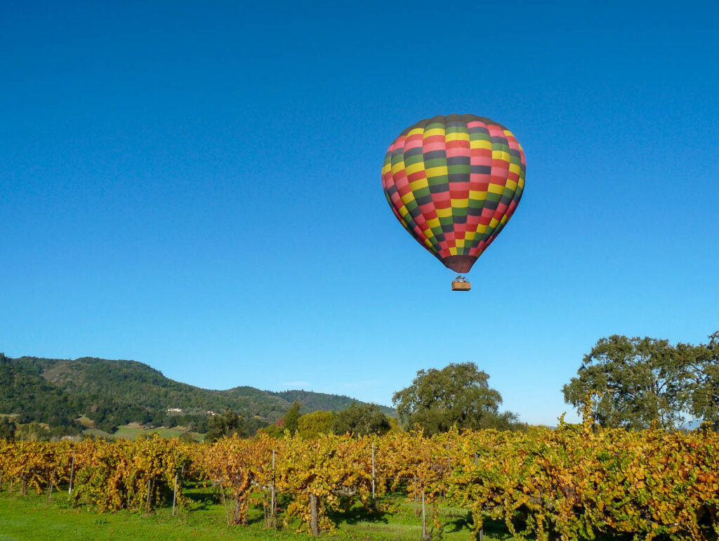
11. Napa Valley
Distance: 58.8 miles / 1 hour 20 minutes
Type: Nature & Outdoors
Best Time to Go to Napa Valley: Fall for grape harvest
Napa started producing wine in the mid-1800s, but the 1976 Paris Tasting vaulted it into global wine fame. Now, it has some of the most acclaimed wines in the country and more than 400 wineries spread across a corridor of just 30 miles.
Start with a scenic drive along the Silverado Trail, a quieter alternative to Highway 29 that passes dozens of vineyards. Calistoga and St. Helena anchor the northern end of the valley with hiking access into the hills above the vineyards. The wine train still runs on a historic rail line and passes through several of the area’s most scenic spots.
12. Sebastopol

Distance: 55.6 miles / 1 hour 15 minutes
Type: Artistic
Best Time to Go to Sebastopol: Spring for blooming orchards
Sebastopol started as an apple-farming town and has grown into a center for artists and sculptors. The town is full of public art and reclaimed materials. The Barlow is a former cannery complex that now hosts galleries, artisan shops, and working studios.
The Gravenstein Apple Fair celebrates the region’s most famous crop every August. At any other time of the year, a drive along Gravenstein Highway takes you through seasonal orchards.
13. Mount Diablo State Park

Distance: 40.6 miles / 1 hour 15 minutes
Type: Nature & Outdoors
Best Time to Go: Winter for the clearest views
Mount Diablo’s summit offers one of the widest viewsheds in the western United States. On a clear day, you can see parts of 40 counties and even a faint outline of the Sierra Nevada.
The Summit Road is a steep but scenic drive that winds up to the visitor center at 3,849 feet. From there, you can take a short loop trails that circle the peak or connect to longer hikes like the Mitchell Canyon route.
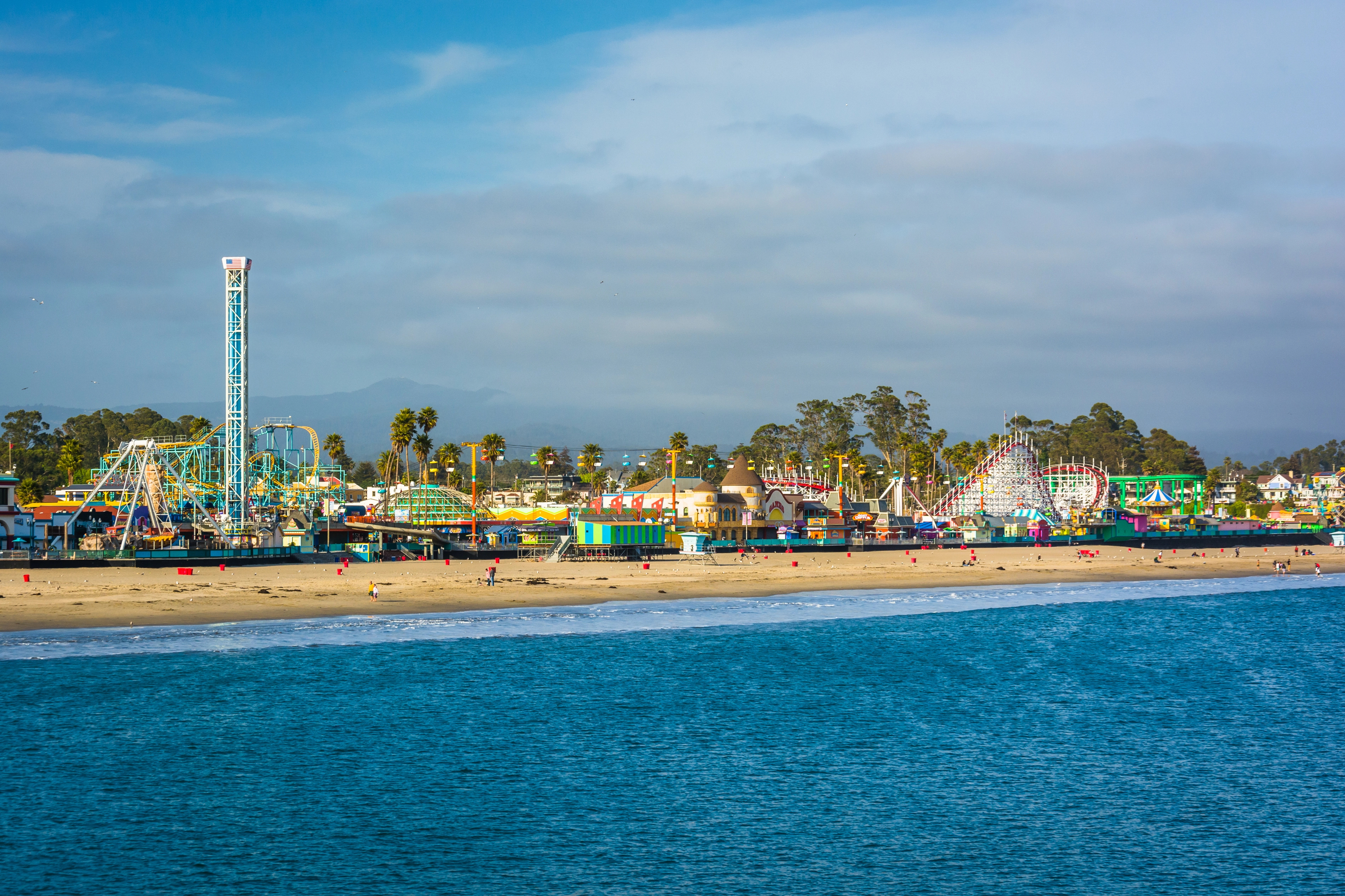
14. Santa Cruz
Distance: 72.9 miles / 1 hour 30 minutes
Type: Nature & Outdoors
Best Time to Go to Santa Cruz: Summer for boardwalk and beach
Santa Cruz is where surfing first arrived in California in the 1880s, introduced by Hawaiian royalty. Today, it’s a laid-back beach town with redwoods on one side and Monterey Bay on the other.
The Santa Cruz Beach Boardwalk is the main attraction, which includes a historic wooden roller coaster and indoor arcade. Natural Bridges State Beach is known for its rock arch and seasonal monarch butterfly migration. The town also has several surf breaks visible from the cliffs, including the famous Steamer Lane.
15. Guerneville

Distance: 74.9 miles / 1 hour 30 minutes
Type: Nature & Outdoors
Best Time to Go to Guerneville: Summer for river swimming
Guerneville sits along the Russian River and has long been a summer destination for Bay Area residents looking for a forested escape. It also serves as an access point for the largest state park in the redwood belt.
Johnson’s Beach is the main launch point for swimming, canoeing, and lazy river floats and is within walking distance of downtown. Armstrong Redwoods State Natural Reserve has a grove of old-growth trees with trails that vary from short loops to longer climbs.
16. Calistoga

Distance: 74.1 miles / 1 hour 30 minutes
Type: Nature & Outdoors
Best Time to Go to Calistoga: Fall for vineyard colors
Calistoga is famous for its geothermal features, including a geyser that erupts regularly and several natural hot springs. The town sits at the northern end of Napa Valley.
The Old Faithful Geyser of California shoots off every 30 to 40 minutes. Nearby, the Petrified Forest has fossilized trees formed by a volcanic eruption over three million years ago. The Calistoga Speedway, one of the oldest dirt tracks in the state, sometimes hosts local races in summer.
17. Healdsburg
Distance: 69.5 miles / 1 hour 20 minutes
Type: Urban
Best Time to Go to Healdsburg: Fall for smaller harvest events
Healdsburg sits at the meeting point of three wine-producing regions: Dry Creek Valley, Russian River Valley, and Alexander Valley. It has evolved from a farming town to an upscale getaway while keeping a compact and walkable core.
The central plaza is shaded by old trees and surrounded by galleries, tasting rooms, and shops. The Russian River runs just outside town and has public access points for tubing and kayaking.
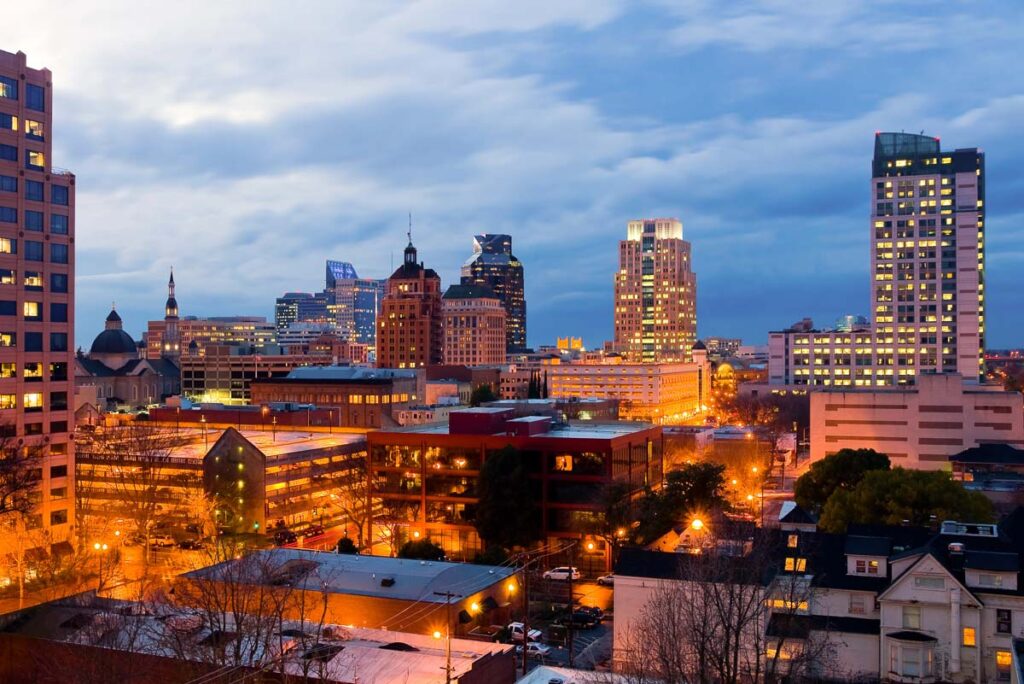
18. Sacramento
Distance: 87.6 miles / 1 hour 40 minutes
Type: Historical & Cultural
Best Time to Go to Sacramento: Spring for mild weather
Sacramento is California’s capital and one of the oldest cities in the state, and it still uses its original street grid.
Old Sacramento Historic District preserves several Gold Rush-era buildings. It sits right on the river, with boardwalk-style sidewalks and views of the Tower Bridge. Midtown Sacramento is full of Victorian homes and wide boulevards, with murals on nearly every block.
San Francisco Day Trips: Around or Less than 3 Hours
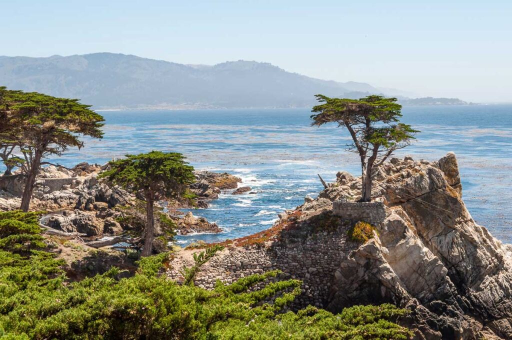
19. Monterey
Distance: 120 miles / 2 hours 10 minutes
Type: Nature & Outdoors
Best Time to Go to Monterey: Fall for clear coastal skies
Monterey Bay is home to one of the deepest submarine canyons along the continental United States, which explains why marine life here is unusually active. This place comes loaded if you’re chasing salt air and actual things to do beyond the beach.
The Monterey Bay Aquarium anchors the waterfront and is worth the ticket, especially for its Open Sea exhibit. Walk the Coast Trail through Cannery Row and out toward Lovers Point for sea otter sightings and uninterrupted bay views. If you have time, take a short drive along the 17 Mile Drive through Pacific Grove and Pebble Beach to catch iconic west coast beach views without needing to go all the way to Big Sur.
20. Carmel-by-the-Sea
Distance: 122 miles / 2 hours 10 minutes
Type: Artistic
Best Time to Go: Spring for gallery hopping and walks
Carmel-by-the-Sea banned street addresses, chain stores, and even high heels without a permit to preserve its original village character. It has more art galleries per capita than almost any other town in the US.
Downtown is a maze of courtyards, alleyways, and historic cottages, many of which house working galleries and small boutiques. The beach is a deep crescent of white sand backed by Monterey cypress trees. Scenic Road is a one-lane loop that hugs the coast and passes hidden stairways down to tide pools and pocket beaches.
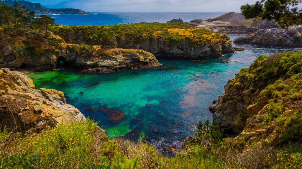
21. Point Lobos State Natural Reserve
Distance: 125 miles / 2 hours 15 minutes
Type: Wildlife
Best Time to Go to Point Lobos: Spring for sea lions and flowers
Point Lobos is sometimes called the “crown jewel” of California’s state park system. It holds rare plant communities, protected marine habitats, and one of the best coastal trail networks on the Central Coast.
Hike the Cypress Grove Trail for gnarled Monterey cypress trees that only grow naturally in two places on Earth. Sea lions and harbor seals crowd the rocky beaches below, especially near Sea Lion Point.
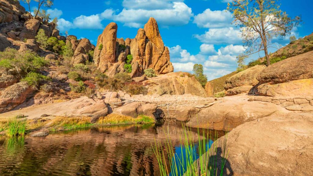
22. Pinnacles National Park
Distance: 123 miles / 2 hours 15 minutes
Type: Nature & Outdoors
Best Time to Go to Pinnacles National Park: Winter for cooler hiking
Pinnacles is California’s newest national park, established in 2013, and one of the few places where you can see California condors in the wild.
Trails like the High Peaks route involve narrow steps and railings along jagged volcanic spires that look like something out of a movie. Bear Gulch and Balconies Caves are talus caves formed by fallen boulders and are walkable when water levels are low.
There are two entrances to Pinnacles, west and east, but they don’t connect by car. You’ll need to drive around the mountains to visit both sides of the park.
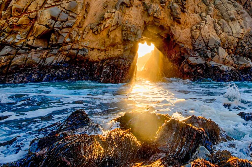
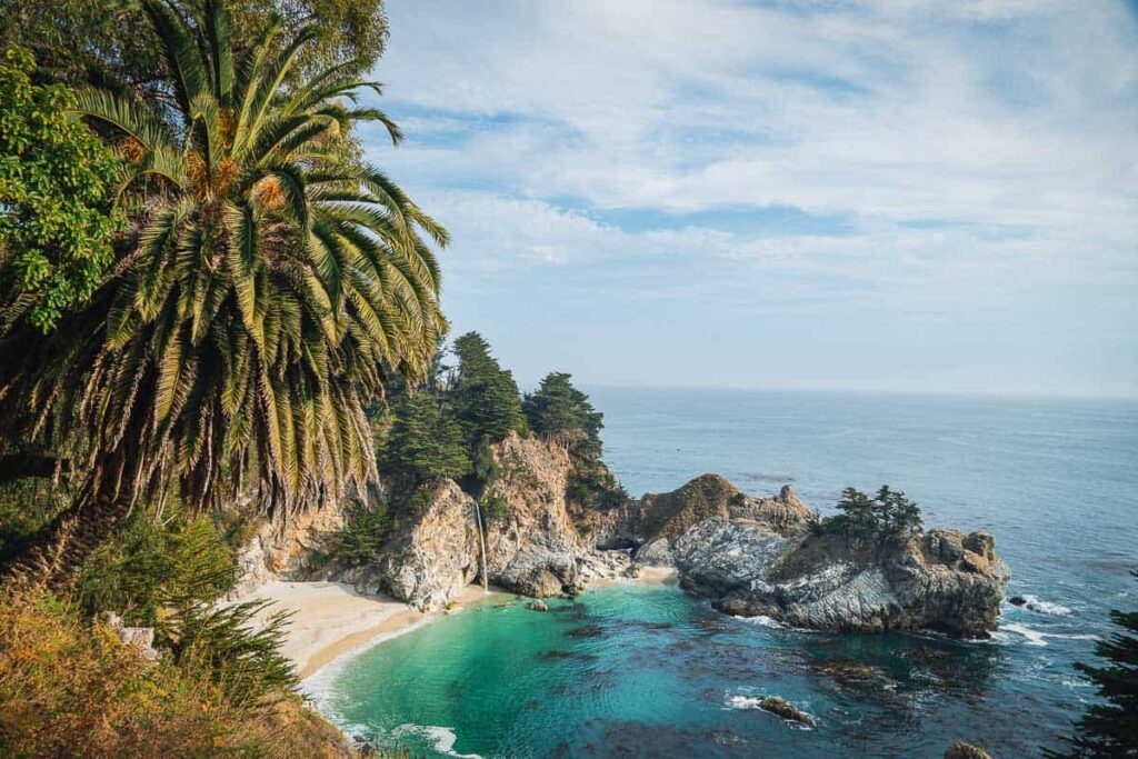
23. Big Sur
Distance: 146 miles / 2 hours 40 minutes
Type: Nature & Outdoors
Best Time to Go to Big Sur: Spring for waterfalls and full rivers
Big Sur’s coastline runs for about 90 miles along Highway 1 and has no official boundaries. This stretch is one of California’s most iconic day trips.
McWay Falls at Julia Pfeiffer Burns State Park is one of the only waterfalls in California that drops directly onto a beach. Pfeiffer Big Sur State Park has redwood groves and trails alongside the Big Sur River. Best Time to Go to Lake Tahoe famous US bridge with pullouts on both sides of the span.
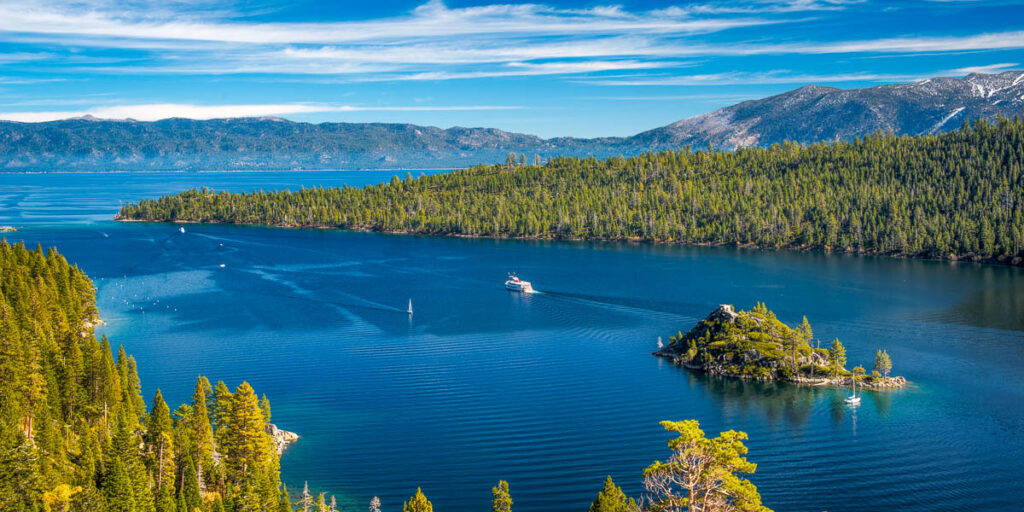
24. Lake Tahoe
Distance: 199 miles / 3 hours 10 minutes
Type: Nature & Outdoors
Best Time to Go to Lake Tahoe: Winter for skiing and snowshoeing
Lake Tahoe is the largest alpine lake in North America. It straddles the border of California and Nevada at 6,200 feet above sea level. It formed over two million years ago and is deep enough to submerge the Empire State Building.
In winter, the area is best known for downhill skiing at expensive resorts like Heavenly, Northstar, and Palisades Tahoe. Emerald Bay State Park is a popular hiking place in warmer months with a Scandinavian-style stone mansion and underwater shipwrecks from Tahoe’s early transport days.
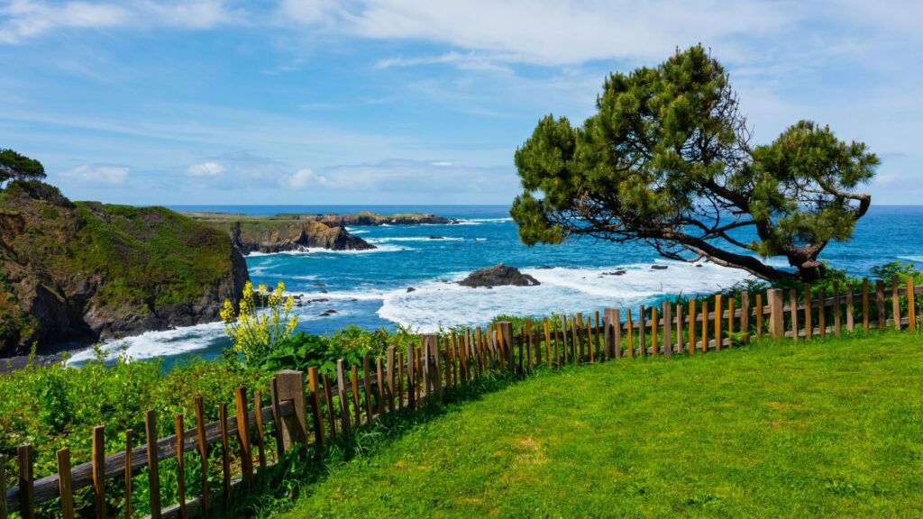
25. Mendocino
Distance: 155 miles / 3 hours 10 minutes
Type: Nature & Outdoors
Best Time to Go to Mendocino: Spring for cliffs and quiet
If you think San Francisco is northern California, you only have to drive a few more hours to Mendocino and realize you were wrong. Mendocino perches on a coastal bluff surrounded by state parks and forest land. Its isolation has kept its Victorian architecture and small-town scale largely unchanged.
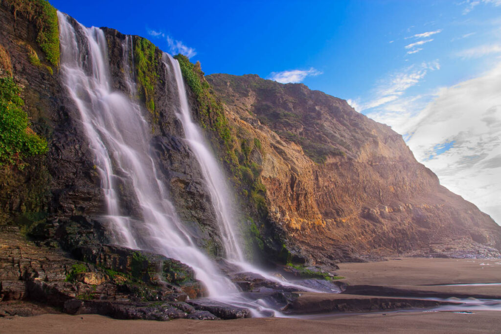
Mendocino Headlands State Park wraps around the town with access to small beaches tucked between rock formations. Nearby, Russian Gulch State Park has a collapsed sea cave and waterfall that is reached by a redwood-shaded trail.
26. Yosemite National Park

Distance: 167 miles / 3 hours 15 minutes
Type: Nature & Outdoors
Best Time to Go to Yosemite: Spring for waterfalls at peak flow
If you want to go from San Francisco to Yosemite in one day, you’re in for a long day. It’s much better to stay overnight, as this iconic national park is worth it.
Yosemite holds nearly 90 percent of California’s high-elevation wilderness. Snowmelt feeds Yosemite Falls, Bridalveil Falls, and Vernal Falls in spring. Glacier Point and Tunnel View are two of the most visited lookouts.
Yosemite Valley is ringed by cliffs like El Capitan and Half Dome, and climbers are often visible from the road. The Mariposa Grove of Giant Sequoias is home to some of Earth’s oldest and largest trees.

Catherine, a seasoned travel writer, has lived in 4 different states and explored 36 states and 28 national parks. After spending two years embracing van life, she's now dedicated to sharing her vast knowledge of day trips across America. Catherine's other works has been referenced in major publications like MSN, Self, and TripSavvy.
| MY FAVORITE TRAVEL RESOURCES |
✈️ Find amazing guided tours and experiences with Viator to maximize your time! 🏘️ Plan ahead and secure your accommodation with Booking.com in advance. 🧾 Rent a car with Discovercars in advance and get the best prices for your day trip adventures. |